Tag: Multi-agency Situational-awareness
-
Bhutan Evaluated Sahana Eden as a replacement and enhancement for their Disaster Information System
Demonstration of Sahana tools for emergency response and crisis management to support data informed decision making
-
SAMBRO Tested and Myanmar is Ready to Go Live
The Myanmar Department of Meteorology and Hydrology (DMH) is now publishing live CAP feeds through their Warning and Situational-Awareness platform. Prior to making the decision to publish live alerts, through the CAP-enabled Sahana Alerting and Messaging Broker (SAMBRO), DMH and associated Stakeholders conducted a series of silent-tests and live-exercises. The silent-tests, carried out over three…
-
Myanmar trained their SAMBRO Users
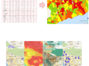
Myanmar SAMBRO Users pose with their situational-awareness map in the backdrop. After two days of training (25 & 26 Feb, 2016), they now have a better understanding as to how the system will improve their alerting efficiency and institutional responsiveness to local and national scale hazard events. The Key Myanmar Users received training, from the…
-
One week after, SAMBRO Users asking for more of Sahana
“You guys have put in a lot of thought in to the SAMBRO design“, a participant said. The first week of the Training of Trainer program had the participants learn about GIS and Sahana. They went further into learning about the tools and techniques associated with GIS, specifically intended for risk mapping. Thereafter, the participants…
-
Training of SAMBRO Trainers
Sahana Alerting and Messaging Broker (SAMBRO) continues to mature; especially with the Maldives, Myanmar, and Philippine implementations. Trainees from the three countries belonging to their Meteorological and Disaster Management Agencies are receiving training. They will receive training on GIS concepts, techniques, and tools required for developing predefined alert areas and training on administering, configuring, and…
-
Few weeks after the workshop Myanmar faces massive floods
Two weeks after the ‘CAP on a Map‘ project kick-off workshop, the Department of Meteorology and Hydrology got busy responding to the massive floods – “Heavy seasonal rains caused flooding in Rakhine State and other parts of the country at the end of June. At the beginning of July, the Relief and Resettlement Department (RRD)…
-
Philippines is ready, set, go with CAP on a Map
The Philippines Atmospheric, Geophysical, and Astronomical Services Administration (PAGASA), Philippines Institute of Volcanology and Seismology (PHIVOLCS), and the National Disaster Risk Reduction and Management Council (NDRRMC) are three agencies of foremost importance. Combined they are responsible for the monitoring, detecting, and warning of key natural hazards that continue to threaten and impact the Archipelago. On…