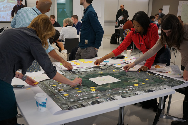
I had the pleasure of attending the International Conference of Crisis Mappers (ICCM) in my home town of New York City. I was particularly excited about this event because I provide emergency management solutions to nonprofits in the New York City area, and I see lots of opportunities for these organizations to adopt some of the better practices and software tools being developed by the international humanitarian scene. So it makes me really happy when an event like ICCM comes to my town.

The event was amazing: bringing together people from a variety of humanitarian focused organizations, including OEMs from around the world, software companies, humanitarian aid organizations, open source projects and lots of folks from the volunteer “crowd sourcerer” community – groups including Standby Task Force, Digital Humanitarians, and Humanitarian OpenStreetMap.
On the first day, there was a tour of NYC’s EOC (emergency operations center), which I missed to attend sessions about grassroots community resilience organized by GreenMaps and citizen science by PublicLab.
GreenMaps is a decades old project based out of NYC that helps communities around the world map their sustainable features. The organization focused initially on print maps, creating icons for specific types of sustainable features (like community gardens) and facilitating real world mapping sessions within communities. They toured us around the Lower East Side, and explained how community gardens, anarchist squats and community organizing spaces enable them to defend themselves for all types of disasters. Their human technology is amazing, but their computer technology is stuck in Drupal 6 (such a common story) and they need an upgrade.
PublicLab supports a community of “DIY scientists” by developing software, hardware and curriculum that drops the costs associated with scientific experimentation. During their session, we used a cleverly designed piece of cardboard and some of their open source software to turn our smart phones into spectrometers we then used to determine whether a water sample was contaminated with petrochemicals. While environmental tests could be useful for disaster relief and recovery, more interesting is that the depth in which PublicLab community members collaborate online. They can actually get people around the world to use specific tools to follow complicated processes that result in scientifically relevant outcomes. It’s a really interested, and complicated crowd sourced process worth exploring.
Day two consisted of a series of short talks by innovative smaller organizations and longer ones by established institutions. I was left with a sense that the folks at the small organizations were optimists working on underfunded projects that were often focused on empowering communities to solve their own problems while the institutional folks were pessimists struggling to remain effective within the landscape of large humanitarian aid bureaucracies.
This day two presentations and conversation surrounding them got me thinking about how the crowd sourced volunteering phenomenon unfolding in humanitarian aid, represented by the activities of group like Standby Task Force and Humanitarian OpenStreetMap, is similar open source software movement and the civic technology one. I’ll discuss that more in a subsequent post about uniting humanitarian and civic technologies.
In the afternoon I attended a “deeper dive” session about open source drone mapping, led by the founder of OpenDroneMap. Apparently it’s become quite easy to automate the process of flying a drone, taking photos of a specific area, and weave those photos together to create a two dimensional map. The next step is use those same basic processes to create a three dimensional model of the space. There are many uses for this: from architectural surveys to search and rescue, and of course, creating immersive virtual environments of real places. <cliche> With drones, the sky truly is the limit.</cliche>
In conclusion: the event was remarkable. The people who attended were passionate. The technologies presented were powerful and disruptive – and the disruption is only just beginning. We’ll need more people, more technology and a lot more collaboration within the “open humanitarian” community to truly shake up the standard operating procedures still in effect throughout the industry, but we’re certainly on our way.
Photo Credit: Fumi Yamazaki


Leave a Reply